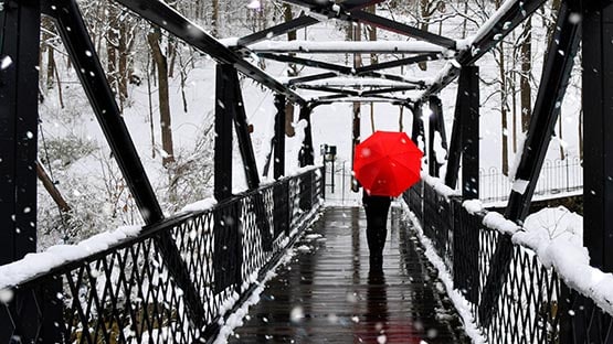
It may not be time to break out the snow shovels just yet, but the Shenandoah Valley does have its first chance of snow next week.
On Monday night, AccuWeather is calling for 0.6” of snow in Waynesboro and Staunton, according to its weather app.
Senior Meteorologist Thomas Kines said “there is at least a chance of snow,” but “it’s also possible Monday night ends up dry.”
Kines said the Valley is on the fringe of getting snow; the storm is “not big by any means.”
“There could be an accumulation in the mountains – maybe an inch or two – but I highly doubt there would be an accumulation anywhere else,” he said.
Even if there is no snow, it will be the first dose of frigid temperatures in the Valley. Even if you don’t need a snow shovel, you might want to dig out winter gear for the family: jackets, hats, scarves and gloves.
For gardeners, it may also be the first hard freeze of the season so get those spring flower bulbs in the ground, and bring tender plants inside.
AccuWeather is calling for a high temperature of 43 degrees and low temp of 28 degrees in Waynesboro with wind gusts up to 14 miles per hour. Similar temperatures are forecast for Tuesday.
“Temperatures will feel more like mid-December or even Christmastime in many places by next week,” said Paul Pastelok, AccuWeather lead long-range meteorologist.
“This will be the first taste of wintry weather for millions from this weekend to early next week, with a dramatic temperature drop and blustery winds,” said Pastelok.
Long-range winter weather forecast
Throughout most of the state, temperatures are predicted to be above normal for most of the winter, and snowfall is expected to be in normal ranges; precipitation could end up above normal in the mountains.
The best chance for winter storms in Virginia appears to be early December and during the month of February.
“Snowfall should end up close to normal, but if the colder airs wins out during one or two of the storms in February, snowfall could end up being above normal,” Kines said.
It’s a mixed bag for the rest of the country as far as temperatures are concerned.
“In general, the western part of the country should be above normal temperature-wise as should be the east coast and the Gulf coast,” Kines said. “The Midwest and Great Lakes should be colder than normal. Precipitation will be above normal in the Great Lakes to the Appalachians. Precipitation will be below normal in the southern Plains, southern Rockies and the southwest part of the country.”
AccuWeather predictions for Virginia
- December through February: East of I-95 corridor, temperatures expected to average above normal; west of I-95 corridor, temperatures expected to average close to normal
- December: Temperatures will average close to normal; perhaps above normal at the coast
- January: Temperatures will average above normal statewide
- February: Temperatures will average above normal along and east of the I-95 corridor; near normal elsewhere in the state; mountains could end up with below normal temperatures
‘The Farmer’s Almanac’ makes its call for region
The Old Farmer’s Almanac winter weather forecast for the region predicts colder than usual temperatures for a wide swath of Pennsylvania, Maryland and Virginia. The region includes the Shenandoah Valley, Roanoke, Scranton, Frederick and Asheville.
The coldest periods are predicted in mid- to late December, early and late January and early February.
Precipitation is predicted to be below normal.
Support AFP


Crystal Graham