A pair of virtual field trips prepared by two James Madison University geology professors have been placed in the “Exemplary Teaching Activity collection” by the National Association of Geoscience Teachers.
Steve Whitmeyer and Lynn Fichter were notified of the achievement by Anne Egger, executive director of the NAGT.
The field trips, “Virtual Field Trip to the Blue Ridge Province, Central Virginia” and “Virtual Geologic Mapping Exercise at Lough Fee (Ireland)” are available on the Teach the Earth portal managed by NAGT and are best completed using the web version of Google Earth.
“This site is the go-to resource for all levels of Earth science educators, and your work places JMU’s virtual field activities as a resource and example for the greater educational community,” geology department head Steve Leslie wrote in an email congratulating Whitmeyer and Fichter. “It also keeps JMU in the spotlight as a leader in geoscience field education through innovative pedagogy in our changed and rapidly changing ‘field education’ environment.”
Whitmeyer said NAGT had accumulated hundreds of exercises on the portal over a number of years and decided to have small groups evaluate them and identify the most useful for inclusion in the exemplary collection. “It’s always nice to have some validation of what you’re doing,” he said.
Fichter said it took hours to curate photographs and other materials needed to produce the lessons. “You want to try to reproduce that spontaneity (of a live trip) in a form that is not that spontaneous,” he said. Fichter added that he visualized the Blue Ridge trip with his eyes closed, “from getting in the vans, driving out there, giving step-by-step directions, so the analysis of the outcrop is as close as possible to actually being there.”
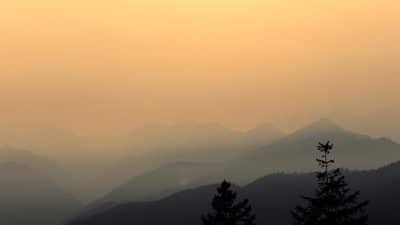
The Blue Ridge field trip is typically a component of a semester-long project for the upper-level undergraduate “Stratigraphy, Structure, Tectonics (SST) class” at JMU. The standard project includes a full-day field excursion, during which students visit sedimentary, igneous and metamorphic rocks of the Blue Ridge Geologic Province in central Virginia. Students collect data on igneous and metamorphic composition and textures, stratigraphic and sedimentological features, and structural/deformation features and use the data to draft a cross-section that transects the Blue Ridge. They then write a tectonic summary of the region.
The objectives of the Lough Fee virtual field trip exercise are similar, but instead of personally collecting the data in the field, students are provided with a web-based Google Earth virtual field trip that covers the standard field locations, plus a few additional sites. The web presentation allows students to virtually investigate the field data at each location via text descriptions, outcrop and sample images, and at some sites, 360˚ Street View and photo sphere imagery and/or narrated outcrop videos.
The Lough Fee field trip is designed as an introductory mapping exercise in a typical undergraduate capstone field course.
Fichter and Whitmeyer said they had talked about creating virtual field trips a couple years ago, long before the COVID-19 pandemic made them necessary, and they already had some experience working with the Google Earth software. “If you were looking for an area where you want to do these virtual field trips, you would be hard-pressed to find someplace better than right here,” Fichter said, noting that geology educators from other parts of the country often travel with their students to the central Shenandoah Valley.
In addition to creating something valuable for other educators, Whitmeyer said the work has been beneficial to them. “We have to think about what it is that we really want to get across. It’s a good pedagogic tool to reevaluate what we do on these field trips.”
While the virtual trips help fill a void during the pandemic and have some strengths, the real thing would be nice to do as well. “Probably the greatest concern I have,” Fichter said, “is that hands-on experience, actually crawling on the rocks, getting there with a hand-lens and looking, is missing and I don’t know if virtual trips fill that gap.”
In the future, Whitmeyer said, “We plan to incorporate these virtual field experiences in a hybrid approach that combines the best of both virtual and hands-on field education.”
Fichter said, “Real-time trips put the students directly in contact with the Earth as it is, not as an interpretation based on someone else’s experience, and that is invaluable and irreplaceable. But virtual trips allow us to rearrange the order in which we visit stops, allow us to pull together observations from more than one outcrop of the same formation to build a more complete data base, allow us to bring in interpretive tools normally not possible on a real-time trip.”
Department head Leslie and professor Eric Pyle are also building virtual field trips for other courses in the department, Fichter said.
Support AFP


AFP