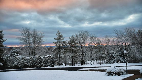
There’s a triple threat brewing that will impact Virginia with mixed precipitation including snow, ice and rain this week.
The first storm might pack the biggest punch with snow starting as early as Monday night and potentially shifting to ice on Tuesday.
“There is the risk of the snow changing to freezing rain Tuesday afternoon or night, although our gut feeling is the storm is mainly snow,” said Thomas Kines, a senior meteorologist with AccuWeather.
Three to six inches of snow is predicted for Waynesboro and surrounding areas which will result in poor travel conditions Tuesday.
In the southeastern part of the state, Kines said it will likely be rain or freezing rain followed by rain.
“There is potential for more,” Kines said. “There is also potential for less. It all depends on how much freezing rain and sleet mix in. The more sleet and freezing rain that gets involved, the less accumulation there will be.”
A second storm will impact the state on Wednesday or Thursday.
“The timing of storm number two is somewhat of a question mark right now,” Kines said. “This looks to be a warmer storm so frozen precipitation at the onset will probably change to freezing rain then plain rain.”
The southern and eastern parts of the state should see mainly rain from this storm.
“As if two storms is not enough, a third storm is possible over the weekend, but storm number three is probably all rain, perhaps starting as freezing rain,” Kines said.
AccuWeather predicts a busy weather pattern ahead in the seven to 14-day period following storm number three.
“We are concerned about colder weather returning after storm number three,” Kines said. “If the colder air does return, we might have to deal with another round of snow.”
Support AFP


Crystal Graham