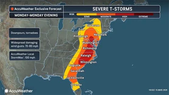
Virginians should keep an eye out for severe weather conditions on Monday with the possibility for a tornado, large hail and damaging wind gusts.
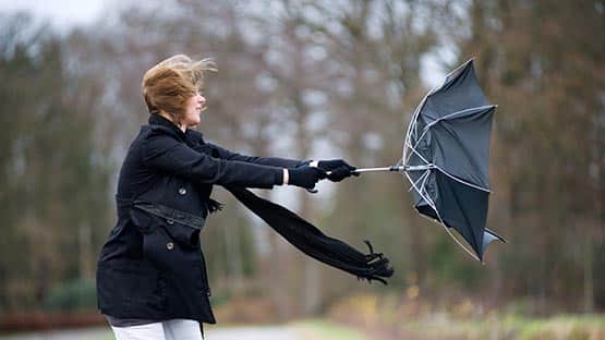
Straight-line wind gusts up to 80 miles per hour are possible throughout a wide swath of the Commonwealth resulting in downed trees and power lines.
“A very strong cold front crosses the state Monday accompanied by a high risk of severe weather statewide,” said Tom Kines, AccuWeather senior meteorologist.
The prime threat period for the mountains and the Shenandoah Valley is from 10 a.m. to 4 p.m. on Monday.
East of the Shenandoah Valley, it’s in the afternoon and evening that heavy downpours and isolated tornadoes are possible, potentially impacting the commute home in Washington, northern Virginia and Richmond.
Some schools in the Richmond area have already announced they will be closed on Monday due to the severe weather potential.
“It’s that part of the state that has the highest risk of widespread severe weather,” Kines said. “However, all parts of the state need to be on top of the latest forecast, watches and warnings.”
“This is a serious threat and should not be taken lightly.”
“A few tornadoes, including the possibility of an especially intense tornado, cannot be ruled out, especially from near the Baltimore and Washington, D.C., metro areas through Virginia and into North Carolina,” said AccuWeather Chief Meteorologist Jon Porter.
Ground stops may also take place at airports throughout the state.
A statewide tornado drill, part of Severe Weather Awareness Week, took place on Tuesday, March 10.
If you are in an area with a tornado warning, you should go to a basement or interior room away from windows. If you are in your car, and a tornado is approaching, the National Weather Service recommends abandoning your car and seeking shelter in a low lying area such as a ditch or ravine.
Support AFP


Crystal Graham