“One of the things we like to say about the Rappahannock is that it’s really a couple of rivers in one,” said Lawton Clites, a Fredericksburg kayaker who first paddled the river 17 years ago.
Clites gives tips for safely navigating the Rappahannock as an educator at River Rock Outfitter in downtown Fredericksburg. He describes the river’s shifting form in slices as it passes through the region. Whitewater rapids run through the middle of town, powering at their hardest just up from the Route 1 bridge, after which the waters slow into green glass as tidal flatwater. This spot at the fall line bustles with people and wildlife in spring. They come for the shad run, an upriver rush of spawning migratory fish that usually takes place between March and April.
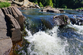 “You’ll know when it’s popping because you’ll cross the Route 1 bridge and look over and see eagles, ospreys, great blue herons, and fly fishermen in waders down in the rapids,” said Clites.
Clites is part of a growing community of Fredericksburg fishers, canoers, kayakers, stand-up paddle boarders, naturalists, hikers, walkers, bikers, and climbers who enjoy their region’s piece of the Rappahannock. As their numbers grow, so too does the entire Fredericksburg region, with the southward swell of populations along the Interstate 95 corridor from Washington, D.C.
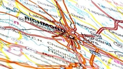
The City of Fredericksburg and the nearby counties of Stafford, Spotsylvania, King George, and Caroline are projected to increase in population by more than 40 percent by 2040. Urbanization and development will follow. For those who aim to protect and enjoy a healthy Rappahannock, a natural question has arisen: How will the changing landscape affect the region’s watershed?
David Sample, a professor in the Department of Biological Systems Engineering, will lead a project to monitor urban runoff quality from Fredericksburg’s local sub-watersheds and assess stormwater controls. Sample will be assisted by Ben Kisila, an associate professor in the University of Mary Washington Department of Earth and Environmental Sciences. Lee Daniels, a professor in the School of Plant and Environmental Sciences, will track the formation of strongly acidic soils in the area and evaluate solutions to mitigate their effects.
Sample will estimate the mass of pollutants – nitrogen, phosphorus, and suspended solids – from the City of Fredericksburg’s stormwater system during storm events, working from five sites linked to five different forms of land use: residential, high-density residential, commercial, industrial, and parks. This work marks a comprehensive research effort to revisit pollutant loads developed in a national study nearly 40 years ago – values that still guide state and federal storm water management programs today.
Sample sees Fredericksburg as a kind of “Goldilocks city” for monitoring urban runoff water quality. It is small enough to gather data efficiently, but large enough to represent similar urban areas many times Fredericksburg’s size.
“My research group has worked in larger urban areas like Virginia Beach and Northern Virginia, and their stormwater systems are extremely complex,” said Sample. “We need very detailed data at a small scale to develop the model and assess the sub-watersheds. Fredericksburg is compact in terms of scale and size, making our effort easier. However, Fredericksburg is very urban and growing fast, so we can make a difference here by providing this information now.”
Sample’s team will conduct monitoring using methods from his ongoing research in Virginia Beach, where he has gathered runoff water quality data and developed modeling to evaluate stormwater controls, or “best management practices” (commonly referred to as BMPs). In Fredericksburg, Sample’s team will divide the area into watersheds and select five locations linked to different land uses, taking samples at the lowest point of each watershed.
The research group will use the collected data to “train” a model to recreate runoff flows and water quality of each sub-watershed.
“By matching observed events, the model can be used to predict water quality given any series of storm events from historical rainfall records, or projected rainfall from climate models,” said Sample.
Modeling will also allow the researchers to simulate the effectiveness of best management practices. To comply with mandates for pollution reduction in each Virginia county, local stormwater management programs rely on BMPs to reduce runoff and improve water quality. BMPs can include policy, behavior change (like reduced fertilizer use), and physical structures like retention ponds and rain gardens. Sample’s model will evaluate how structural BMPs can best be sized to treat the estimated pollutant loadings identified.
Recently, his team developed a way to control the model and run it repeatedly to select the most cost-effective group of BMPs for meeting downstream water quality goals. If runoff water quality loads are found to be cleaner than measured 40 years ago, stormwater management programs may be informed to adjust for potentially lower-cost structural BMPs. With updated water quality data and recommendations for cost-effective BMP installation, the Fredericksburg region and others across Virginia can plan smarter for reducing pollution in their watersheds.
Lee Daniels will track and investigate solutions for a water quality issue that starts with the excavation of soil and underlying geologic materials. Naturally occurring sulfidic materials are present under much of Fredericksburg’s land, according to Daniels, who has studied soil in Fredericksburg and surrounding counties since the late 1990s.
Land clearing and construction activity for projects like housing developments, airports, and industrial parks can trigger the formation of what are known as “acid sulfate soils” during excavation. These extremely acidic soils eat away at metal and concrete building materials, compromise structural stability, allow for acid runoff and erosion, and pollute surface water. Homeowners can see acid sulfate soil processes manifesting in dead lawns and red-stained, crumbling sidewalks.
Daniels will collaborate with the development community, mainly geotechnical engineers, to acquire and map geological data pinpointing where new rounds of active development will take place. Daniels and post-doc Zenah Orndorff will collect samples of soil materials from those sites to test for the presence of acid-forming materials and analyze the need for remedial treatments like liming or isolation. They’ll then make treatment recommendations and evaluate their longevity. Daniels also aims to dive deeper into the issue in the context of water quality.
“If leaching and runoff from acid-forming materials aren’t treated properly, extremely acidic and metal-rich water kills headwater streams,” said Daniels. “There’s a direct threat to local water quality and to species such as fish, frogs, turtles, crabs, and whatever else is living in those receiving streams. There’s no question that there are and have been significant, very negative local impacts from the acid-forming materials to local drainages.”
Collaborating with Sample, Daniels will evaluate the effectiveness of BMPs like retention ponds and rain gardens, as well as their modifications for mitigation of acid sulfate soil processes.
“This is about being more prescriptive and proactive, so we know ahead of time exactly what BMPs need to be installed, and can get them in the ground before the damage occurs to the soil, structures, and local water quality,” he said.
Both researchers’ projects are supported by the nonprofit Resource Protection Group formed by Michael Rolband of Wetland Studies and Solutions Inc., and by Buck Cox, an environmental engineer and entrepreneur who studied biology at Virginia Tech and received his doctoral degree in environmental engineering from the university in 1981.
The two projects represent the kind of work that Cox aims to give a home in the Fredericksburg region, through the establishment of an ecological research and education center on the banks of the Rappahannock River. Cox has worked with Virginia Tech, the University of Mary Washington, Friends of the Rappahannock, and other partners to discuss initial planning for the center.
“In the case of the Rappahannock, the elephant in the room is development,” said Cox. “We’re talking 40 percent population expansion in the next 20 years. Staying ahead of that technically – how you solve the problems that are going to happen – is going to be critically important.”
Cox aims to have the center build upon Daniels and Sample’s research, focusing on projects producing real-time solutions to local and regional conservation issues, with global applications. He also plans to work with students from Virginia Tech’s College of Architecture and Urban Studies to plan for the center’s design as well as students from the College of Agriculture and Life Sciences Department of Agricultural and Applied Economics to develop a business plan for the center and determine the project’s long-term economic feasibility.
Cox also envisions incorporating Cooperative Extension into the center’s work to tap into opportunities for community engagement. He envisions the center as a critical water research hub, a well-situated Virginia tourist attraction, and a place where people young and old can learn to become environmental stewards.
“It’s an educational process,” said Cox. “To get as many people as possible sensitized to the fact that everything they do in the watershed ultimately can affect the river.”
Support AFP


AFP