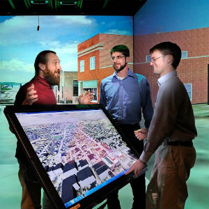
A team effort of the Center for Innovative Technology and Virginia Tech’s Center for Geospatial Information and Technology is working towards the goal of bringing broadband to the commonwealth’s underserved areas to expand economic and workforce development.
Over the past month, the Center for Geospatial Information and Technology, a unit in Virginia Tech’s College of Natural Resources and Environment, has been working closely with CIT to develop a website survey to collect and map broadband access information from Virginia citizens.
“Because the center has been aggressive in building the first geospatially centered and open-source research environment at Virginia Tech, it is uniquely positioned to collect and share large, geospatial, crowd-sourced data sets,” said Peter Sforza, director of the center and an affiliated faculty member in the Department of Geography.
The survey can be filled out at RUOnline.virginia.gov or by calling 877-969-6685. Responses will be mapped and analyzed to inform policy decisions and stimulate broadband funding, installation, and improvement.
“I’m always amazed at what our team can accomplish,” Sforza said. “The ability to leverage large data sets with geolocation as a decision-making tool is very powerful.”
Sforza’s research team includes Brandon Herndon, who serves as the broadband project manager, Brian Farrell, Ji-Sun Kim, Joe Newman, and 33 students. CIT led the partnership with the Center for Geospatial Information and Technology and involved other agencies.
“We are glad that CGIT can help contribute to the broadband landscape in Virginia by making it more transparent to citizens, lawmakers, and providers,” Herndon said.
RUOnlineVa is the key tool the state will use to engage citizens and the private sector for policymakers to fully understand exactly what the broadband needs are so solutions can then be developed.
Once the survey collection is complete, the data will be incorporated into other tools that the Center for Geospatial Information and Technology has already built to help citizens, policymakers, Internet service providers, and all levels of government make the best possible decisions about broadband Internet access.
“In particular,” Sforza said, “the data provided by this effort will help gauge community interest and engagement, and lay the foundation for future conversations in un-served and under-served communities.”
Sforza explained that a key benefit of an open-source geocomputational infrastructure is easier data sharing. “We were able to collaborate with VITA (Virginia Information Technologies Agency) to produce a website (technology.virginia.gov/ru-
CGIT provides real-time responses to the survey, which VITA’s website then ingests to visualize the results, also in real time.
“Using open-source tools was essential to this project,” emphasized Farrell, a project associate. “It’s frequently something that is behind the scenes, but open-source tools allow us to diversify our system so that we don’t rely on one vendor. They also allow our partners to use different tools than we do. We can pick the tools that do the best job.”
On Wednesday, May 25, Gov. McAuliffe signed House Bill 912, which makes it easier to put telecommunications infrastructure in the rights-of-way for state-maintained roads. In addition, the governor’s budget includes $2.5 million for the Virginia Telecommunications Initiative to provide funding for infrastructure expansion in non-served areas of the commonwealth.
At the bill signing ceremony, the governor announced his statewide initiative to map broadband access to find where the gaps in coverage are with the purpose of getting broadband to every part of Virginia. “A 21st century economy requires high-quality broadband infrastructure,” said Secretary of Commerce and Trade Maurice Jones.
“The center is also involved in many other aspects of broadband planning and analysis for the commonwealth,” Sforza added. “With funding from CIT, we built a toolbox of data viewing and exporting tools for broadband coverage, a speed test for Virginia, and a database of local policies for installing broadband infrastructure.”
The Center for Geospatial Information and Technology is an interdisciplinary research center that collaborates across academic, government, and private sectors in the development of innovative geospatial solutions, and in elevating awareness for spatially enabling actionable intelligence and knowledge. It helps solve societal problems through the application of geospatial sciences techniques and provides next generation applied geospatial research in a broad range of areas to address complex problems from local to global scales.


