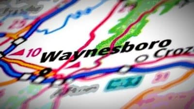
 The Harrisonburg Department of Public Works is seeking state and federal funding for a number of projects aimed at improving safety, walkability and traffic congestion around The Friendly City.
Public Works Director Tom Hartman spoke with Harrisonburg City Council on Tuesday night, informing them of pending applications focused on funding seven potential projects through the Virginia Department of Transportation’s Smart Scale grant program.
The funding, if awarded, would be available for use starting in 2026. Other transportation projects in the near future have either already been awarded Smart Scale funding, or are supported by other funding mechanisms.
The seven projects, which are spread throughout the City and determined based on staff analysis and transportation studies, would potentially bring $20 million in road funding to support Harrisonburg residents and commuters.
“Our team is constantly focused on identifying ways we can bring improvements to our road and sidewalk system,” Hartman said. “Obtaining these funds would allow us to move forward on needed enhancements that will improve safety and walkability at corridors across our city while reducing traffic congestion on South Main Street, Port Republic Road and other key areas. We appreciate the support of City Council on seeking these funds and for their backing of these important projects.”
The applications will be considered against transportation projects from across Virginia. The City will not learn if funding is being awarded until July 2021.
Projects
South Main Street Safety Improvements: This project adds a 3-foot-wide concrete median on South Main Street from just south of Mosby Road to the intersection with Stone Spring Road/Erickson Avenue, with a break in the media to maintain a full-access entrance to Dukes Plaza. The median will prevent left turns into and out of many commercial entrances along this high-crash corridor. The project also adds a five-foot-wide sidewalk on the east side of South Main Street, and shelters at three bus stops to improve multimodal access on the
corridor. A survey seeking public input on this project took place in August 2019.
South Main Street Safety Improvements South Main Street and Interstate 81 Exit 243 Interchange Improvements: On South Main Street at the Interstate 81 Exit 243/Covenant Drive intersection, the southbound approach and on-ramp will be widened to allow dual leftturn lanes from South Main Street onto the on-ramp; the southbound left-turn lanes will be extended to improve storage. The westbound approach will be widened to allow dual left-turn lanes onto southbound South Main Street; the westbound left-turn lane storage will be extended to improve storage and clarify yield and merge conditions. The northbound left-turn lane will be offset from the southbound left-turn lane to maintain the permissive left-turn movement (no widening needed). An overhead wayfinding sign will be added along the southbound approach to the interchange for I-81 on South Main Street. A sidewalk will be constructed from the Holiday Inn Express to Pleasant Valley Road, along the west side of South Main Street, and a pedestrian signal will be added to the South Main Street/Pleasant Valley Road intersection.
Port Republic Road Turn Lane and Sidewalk: This project extends the eastbound Port Republic Road leftturn lane at Bluestone Drive from 100 feet of storage to 300 feet. Road widening and sidewalk reconstruction taking place on the north side of the road, supported by approximately 275 feet of retaining wall, will provide the needed space for the new turn lane length. About 450 feet of 5-foot-wide sidewalk will be constructed on the south side of the project, including a retaining wall for most of its length. A median will be constructed in the functional area of the intersection.
Pear Street/Erickson Avenue Modified Restricted Crossing U-Turn: This project creates a modified Restricted Crossing U-Turn at the intersection of Pear Street and Erickson Avenue as an alternative to a warranted traffic signal. Three out of four left turns, as well as the through movements on the minor approaches, will be redirected to signalized U-turns. A signal will be added at the new U-turn location. A bulbout design at the new U-turn will accommodate buses. Marked crosswalks will be provided at the Pear Street intersection, including a pedestrian refuge and flashing pedestrian beacon to cross Erickson Avenue.
South Main Street at Interstate 81 Pear Street at Erickson Avenue Port Republic Road at Bluestone Drive Port Republic Road Corridor Improvements: This project adds a traffic signal, including signalized crosswalks, at the Port Republic Road/Bradley Drive intersection. Port Republic Road will be widened to create a westbound leftturn lane with approximately 100 feet of storage and 100-foot taper. Sidewalk and bike lane will be reconstructed. A 3-foot-wide concrete median will be constructed along the entire segment between the Bradley Drive and Devon Lane intersections. A channelizing island will be added at the Hunters Road/Port Republic Road intersection to prohibit left turns.
Bluestone Trail Extension: The project closes a 0.7-mile gap between two sections of the Bluestone Trail – a 10-foot-wide paved shared use path – between its current terminus at Stone Spring Road to the new high school that is currently under construction. Path construction on the high school campus extends the Bluestone Trail another 0.5 miles further south. The majority of this project is on independent alignment through City-owned property. A bridge over Blacks Run and the parallel railroad is needed to make this connection.
North Main Street Sidewalk: The project includes the construction of 1,800 linear feet of sidewalk from Holly Hill Drive to Vine Street. Existing curb and gutter will be reconstructed, and new curb and gutter will replace 750 feet of currently open drainage. Signalized crosswalks will be added at the intersection with Vine Street.
Support AFP


AFP