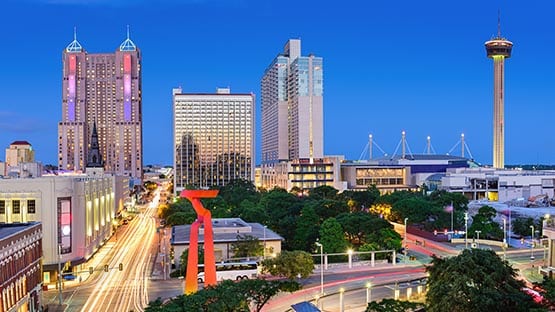
San Antonio does not have a single notorious highway the way some cities do. What it has is a pattern: a set of corridors that produce serious and fatal crashes year after year, and a second set that the city expects to produce them next.
The distinction between those two lists is the more interesting part, and it comes from work the city has already done.
How San Antonio identifies its worst roads
Rather than ranking roads by raw crash counts, the city’s Vision Zero program built two separate maps.
The High Injury Network identifies roadways with high historical concentrations of serious and fatal crashes, drawn from five years of crash data covering 2019 through 2023. The High Risk Network does something different: it uses roadway attributes lane count, speed, access density, pedestrian infrastructure to flag corridors where severe crashes are likely in the future, whether or not they have happened yet.
Both are published through the city’s Vision Zero program, and the underlying incidents can be examined location by location on the city’s public crash map.
Why a small share of roads carries most of the harm
The consistent finding in cities that run this analysis is that severe crashes concentrate on a modest fraction of total street mileage. That is useful rather than discouraging; it means the problem is addressable, and it tells a driver which roads deserve more attention than the map’s mileage would suggest.
The corridors that carry the most risk
The interstate spine
I-35 through the urban core carries commuter traffic, heavy freight moving between Mexico and the Midwest, and drivers unfamiliar with the interchange geometry. The combination produces a constant speed differential, the signature of a corridor where vehicles are doing different things at different speeds within a few feet of each other.
I-10 and the US 281 corridor share the pattern, with the added complication of sustained construction that changes lane configuration on a schedule regular drivers stop noticing.
Loop 410 and the ring roads
The loops carry high volumes with closely spaced entrances and exits, which forces weaving; every vehicle entering must cross the path of every vehicle leaving within a short distance. Weaving sections generate a steady stream of sideswipe and rear-end collisions that have little to do with anyone driving badly.
The arterials, where the severity lives
The corridors that dominate severe-injury and pedestrian data are not highways at all. They are wide, fast surface streets: Bandera Road, Culebra Road, the Military Drive corridors, Fredericksburg Road, designed to move volume, lined with driveways and businesses, and crossed on foot by people whose nearest signal may be a quarter mile away.
Speed is the variable that decides outcomes
The city’s own analysis identifies dangerous driving and speeding among the leading contributing factors in severe and fatal crashes and notes that crashes involving pedestrians and cyclists at higher speeds are far more likely to be fatal.
That relationship is not linear. A modest increase in impact speed produces a disproportionate increase in the chance someone dies, which is why corridor speed is the lever traffic engineers reach for first.
What makes rideshare passengers different
Pickups happen in the worst available spot
A rideshare trip begins and ends with a vehicle stopping somewhere it was not designed to stop: a travel lane on a busy arterial, a driveway apron, a spot chosen because it matched a pin on a map. Passengers open doors into moving traffic, and drivers make late lane changes to reach a waiting rider.
The coverage picture changes mid-trip
Texas regulates rideshare companies under Chapter 2402 of the Texas Occupations Code, which sets permitting, background check, and insurance requirements. The practical consequence for a passenger is that the coverage protecting them depends on the driver’s app status at the moment of impact, and that status is documented only in company records.
Passengers are rarely at fault, which simplifies things
A passenger has no realistic share of blame for how a crash happened. That removes the argument that dominates most claims and leaves a narrower question: which policy applies, and who caused it.
It also means a passenger injured when two drivers blame each other does not have to wait for them to agree. The claim can proceed against whichever driver is ultimately responsible, and the uncertainty stays with the people who were driving.
Why fault on these corridors is genuinely contested
According to Eric “Brad” McClelland, an Associate Attorney in RTRLAW’s Texas personal injury practice, multi-vehicle collisions in weaving sections and on wide arterials rarely produce a clean account of what happened, because each driver experienced a different fragment of the sequence and the responding officer arrives after everything has been moved. Since roadway design frequently explains a crash better than any driver’s recollection, lawyers dedicated to auto injury claims in San Antonio look at lane configuration, signal timing, and sight distance at the specific location, then check the official report obtained through TxDOT against the physical evidence rather than accepting its assignment of fault as settled.
Reports contain errors more often than people expect, including reversed directions of travel, vehicles assigned to the wrong driver, and incorrect insurance information. Corrections are far easier to make in the first weeks than in the second year.
Reducing your own exposure
On the interstates and loops, position for your exit well in advance and leave following distance that feels excessive, since the vehicle ahead may stop for something you cannot see. On the arterials, treat every green light as a moment to pause rather than accelerate, and expect pedestrians where there is no crosswalk, because the crossing distances make mid-block crossing rational.
As a passenger, ask to be dropped somewhere the driver can actually pull out of traffic, exit on the curb side, and take ten seconds to screenshot the trip before closing the app. That record is the fact everything else depends on if the ride goes wrong.
This content is provided for informational purposes only and is not a substitute for professional advice. AFP editorial staff were not involved in the creation of this content.




 Share
Share