
It appears more winter weather is on the way, even as snow removal crews throughout Virginia are working to clean up from last weekend’s storm.
The Shenandoah Valley will see some snow, with one to three inches predicted from Friday night through Sunday. Luckily, it does not appear that any ice will mix in this time.
AccuWeather Senior Meteorologist Tom Kines believes in and around Waynesboro, the accumulation will be closer to one inch.
In Hampton Roads, it’s a different story, with significant snowfall expected and blizzard conditions possible. AccuWeather meteorologists believe the storm may intensify into a bomb cyclone as it moves from the southeast U.S. to the Atlantic coast this weekend, potentially bringing damaging winds, heavy snow and flooding to the coast.
“There should be strong winds at the coast Saturday night and Sunday which can cause coastal flooding and beach erosion,” Kines said. “The southeast part of the state can receive several inches of snow and with the strong winds, it will be a blizzard for those folks.”
The greatest risk for heavy snow at this time appears to be from the Carolinas, Virginia and the Delmarva Peninsula northward along the coast into eastern New England. If the wind gusts reach more than 35 mph for three hours or more, and the visibility drops below a quarter of a mile, then it is an official blizzard.
The accumulation in Norfolk could rank among the top five snowstorms on record for the city.
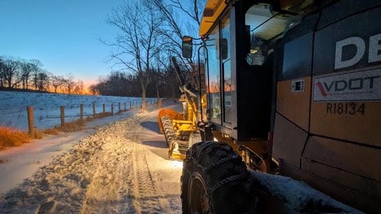
The Virginia Department of Transportation said many roads in the state will not be pre-treated ahead of this storm due to residual salt remaining from the previous storm.
In the Shenandoah Valley, VDOT has used heavy equipment to break apart ice packed on less-traveled roads. Sand has also been used in many of those areas to provide traction for drivers navigating the icy conditions.
Due to the upcoming storm, VDOT reports that it will pause these efforts to focus on what’s ahead before returning to work on lingering patches of ice.
Groundhog Day: Early spring or six more weeks of winter?

Kines told AFP that the cold will ease up some next week, but there is not an extended period of mild weather in the next seven to 10 days.
“Monday is Groundhog Day – hopefully we get good news,” he said.
If the sun is out and the groundhog sees its shadow, the theory is that it means six more weeks of winter. If it is cloudy and no shadow appears, it means an early spring. Many eyes will be on Punxsutawney Phil in Pennsylvania where predictions have been made dating back to 1887.
Punxsutawney Phil has predicted six more weeks of winter five times more often than predicting an early spring. His record, however, when scrutinized, shows he’s been right less than 40 percent of the time.
Whether or not we see Phil’s shadow, temperatures next week will be approximately 10 degrees warmer, and it is likely that some of the snow and ice banks will melt next week.
“Instead of highs in the teens and 20s, there will be days next week with highs in the 30s,” Kines said. “It’ll feel like spring.”
Joking, of course. Typically, high temperatures for next week are in the middle 40s.
Hazardous road conditions may be reported to VDOT at (800) 367-7623 or my.vdot.virginia.gov.