A crash report is a document, not an event. Counting documents and counting danger are related exercises, but they are not the same one, and in Massachusetts the distance between them is written directly into the law that requires the paperwork.
That distinction explains a great deal about which Boston intersections appear at the top of official lists, and why some of the city’s genuinely lethal stretches of road do not.
Massachusetts makes the driver file, not just the police
Most people assume a crash report is something an officer writes. In Massachusetts, the driver has an independent obligation.
Under Chapter 90, Section 26 of the Massachusetts General Laws, every operator involved in a crash in which anyone is killed or injured, or in which there is damage above one thousand dollars to any one vehicle or other property, must report in writing to the Registrar within five days and send a copy to the police department with jurisdiction over the road where it happened.
Why a thousand-dollar threshold produces so much paper
That figure has not kept pace with the cost of fixing cars. A modern bumper cover holds parking sensors, a camera, and sometimes radar hardware that requires recalibration after removal. A low-speed tap at a red light, the kind of contact that leaves both drivers annoyed rather than injured, clears a thousand dollars without difficulty.
The practical result is that a large share of routine urban fender contact is legally reportable. Intersections generate volume because intersections are where slow-speed contact happens.
The duty survives a friendly exchange of information
Two drivers who agree to sort it out privately have still triggered the filing requirement if the damage crosses the line. The statute excuses reporting only while a person is physically incapable of making it, and if an incapacitated operator does not own the vehicle, the owner must file instead.
How “piling up” is actually measured
This is not an impression. MassDOT calculates it.
The state builds crash clusters from the Registry’s collection of state and local police crash reports, then publishes them through its top crash locations map, including the top two hundred intersection clusters. The work is done under the federal Highway Safety Improvement Program, and a location becomes eligible for that funding by ranking in the top five percent within its metropolitan planning organization.
The coding decides the map
Here is the mechanical detail that matters. A crash joins an intersection cluster only if the responding officer coded the junction type as a four-way intersection, a T, a Y, or a five-point-or-more junction.
Code the same collision as a driveway conflict, or leave the field blank, and it never reaches the intersection map at all. The published picture is a map of reports, filtered through a checkbox on a form completed at the roadside.
The geometry that generates volume
Angles the street plan inherited
Boston’s junctions were laid out for foot and cart traffic, which produced acute-angle approaches and five and six-way meetings that no traffic engineer would design today. An approach that arrives at thirty degrees rather than ninety forces a driver to turn their head further to see what is coming, and shortens the window in which they can see it.
Unprotected left turns
The single most productive source of angle collisions in any city is a permissive left, where a driver turns across oncoming traffic on a green ball rather than an arrow. The judgment required is a speed and distance estimate made under social pressure from the car behind.
Junctions doing a highway’s work
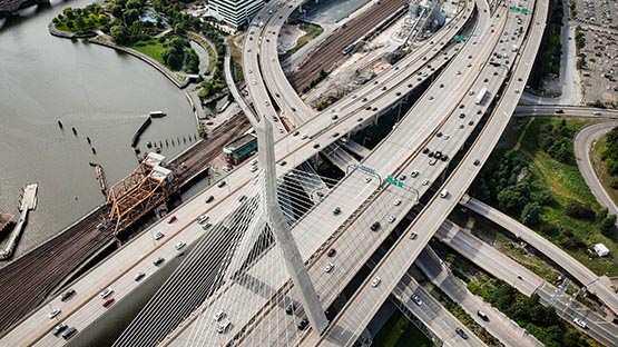
Boston has many surface intersections positioned within a few hundred feet of a ramp, where drivers are simultaneously choosing a lane, reading a sign and reacting to a signal. Crossings near the large circles and squares behave the same way, mixing local turning movements with traffic still carrying highway speed.
Volume and severity are different maps
Nationally, the Federal Highway Administration reports that more than half of all fatal and injury crashes occur at or near intersections, and that intersections account for roughly a quarter of traffic deaths.
Within a single city, though, the highest-count locations are frequently the slowest ones. They produce enormous numbers of reports and very few funerals. Fatal and serious injury crashes cluster instead where speed meets exposure, on wide arterials with long distances between crossings, which is why a corridor can be far more dangerous than the intersection that outranks it on paper.
Why the report becomes the argument later
According to Lance C. Rudzinski, Shareholder and Managing Partner of RTRLAW’s personal injury litigation department, the crash report is treated as a neutral record when it is really a set of judgments made quickly by someone who arrived after the vehicles were moved, and the fields most often wrong are the ones that matter most later, including direction of travel, which vehicle struck which, and the diagram. Since a correction is far easier to obtain in the first weeks than in the second year, crash counsels in Boston pull the report early and compare it against photographs and the physical evidence rather than treating its account as fact.
What to capture before you leave the intersection
Photograph your own approach, from where you actually were, so the angle and the sight obstruction are documented rather than described.
Record the signal you had, and whether it was an arrow or a ball, because the difference decides who had the right of way. Note the cross street names exactly as posted.
And file your own report within five days, even if the other driver seems reasonable and the damage looks minor. It is a legal duty rather than a tactic, and a filing made calmly beats one made after an insurer has started asking why there is nothing on record.
This content is provided for informational purposes only and is not a substitute for professional advice. AFP editorial staff were not involved in the creation of this content.


 Share
Share